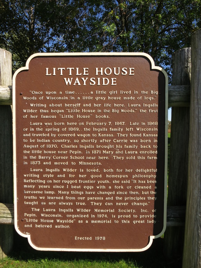
All my life I’ve lived less than a day’s drive from the birthplace of Laura Ingalls Wilder, and had never yet visited it. I’ve been to De Smet, SD (location of Little Town on the Prairie and more) and Walnut Grove, MN (location of On the Banks of Plum Creek) more than once (see the posts here ). But this year, I finally made it.
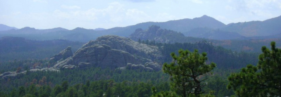
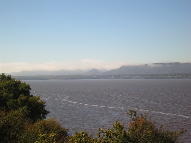
The town of Pepin, Wisconsin sits on the shores of Lake Pepin, a natural widening in the Mississippi River. We had some lovely views of the lake while driving south on the Wisconsin side of the river:
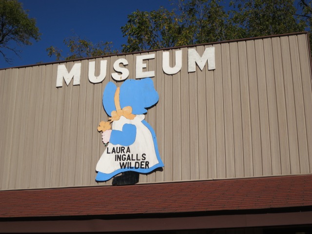
There’s a Laura Ingalls Wilder museum in the town, with tools and household objects from the time period. There is a small fee for the museum (currently $2 for students and $5 for adults) which is open from mid-May to mid-October. More information here.
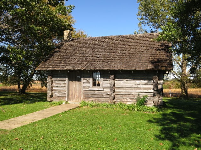
There are directions at the museum to the approximate site of Laura’s birthplace, 7 miles out of town. As we went along the winding road, I tried to picture all the cropland as woods, with only a few roughly cleared roads or paths to keep a traveler from getting lost and wandering for days.
There is a replica log cabin built on land which records show belonged to Pa Ingalls. The cabin is free, and open 24/7. We spread out a blanket and had a picnic lunch on the grass, and then wandered around, imagining what it looked like back when Laura lived there, and how a family of 5 lived and worked in a house so tiny.
For more on my visits to Laura Ingalls Wilder sites, see:
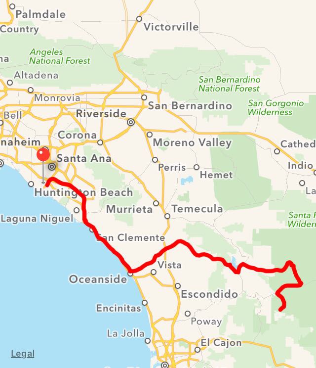
On the last day of my early spring trip, all I needed to do was to get to the airport for an 11:00 flight (as I had originally booked it, the flight was supposed to be leaving at 3pm, but several weeks before I got an email with an unexplained schedule change). Google said the airport was 40 minutes from my hotel in Costa Mesa, but I planned to leave myself lots of time — about 4 hours before the flight time.
I needed it. Everything was going well, I was following my directions and getting close to my goal, when I saw a light-up sign: “Exit closed ahead. Accident on ramp”. Of course, it had to be my exit.
I took the next exit instead, and tried to find my way back. That was quite an adventure; I was basically wandering around in Los Angeles, and I don’t recommend the experience to anyone. One curious thing I encountered was a traffic light, at a wide intersection with basically no traffic, that utterly refused to turn green for me. I had to make a left turn; I kept on inching forward, certain that it couldn’t see me, and nothing ever happened. Finally, rather than run the red light, I made a right turn instead, then a U-turn, and approached the traffic light from the side that was green and went through.
At last, I stumbled upon a street that I recognized as the name of the street where I had picked up my rental car. I had to make a guess which direction to turn, but I guessed right, and soon began to see indications that I was nearing the airport. I was parked at a stoplight only a few blocks from the rental car place, when an accident happened right in front of me: a distinctive sickening thud, and bits of car flying all over the intersection, including a spare tire rolling across. It didn’t look like anyone was hurt, but it was certainly rattling: then, the light turned green, and everybody drove carefully around the vehicle in the middle of the intersection. I was just glad that I had only a few minutes before I was through driving in that place!
There were lines at the rental car dropoff, lines at the luggage dropoff, and lines at security. When I was all through, I had used up almost every bit of the 4 hours I had allowed, and only had a short time to wait before boarding the plane. The moral of the story: the bigger the place, the more extra time you should allow.
Nothing else went wrong, and I had a beautiful flight home.
I had planned to make this trip for around $500, and it came pretty close. It was a bit over, mostly because gas prices had spiked just before I left, plus I hadn’t really allowed enough for the premium price of gas in some remote places, especially Death Valley. Often, there was a 10-cents per gallon discount on gas for paying cash, but I hadn’t brought much cash along so usually had to take the credit-card rate. However, I was very pleased with my choices for lodging and rental car.
The final breakdown on expenses looks like this:
11.20 Flight
109.00 Rental car
177.23 Lodging for 5 nights (32.50, 35.00, 28.13, 33.00, 48.60)
65.10 Food (mostly from grocery stores)
91.62 Gas
30.00 Entrance fees
48.00 Parking at airport
14.48 Souvenirs (for ever trip I go on, I like to get some postcards and a magnet. My other souvenir purchase for this trip actually had a practical element: a bandana printed with a topographical map of Death Valley).
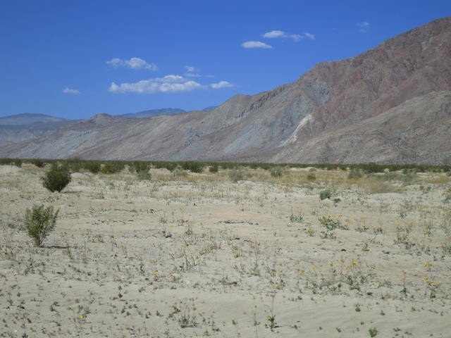
Even in mid-March, the air temperatures in the lowlands of the desert were up to 90 degrees, and protection from the sun was an absolute must. There were no clouds in sight, and the sunlight reflected off sand and rock in an unexpected way. It was the first time in my life I actually felt cooler with more clothes on, but with a bandana draped under my hat and a long-sleeved shirt that I wore loose over my shoulders so that I could hold it out and catch the very little breeze, I felt more or less comfortable. A canteen filled with water, of course.
I didn’t want to get lost, and distances were very deceptive, so I picked an area where mountains blocking the way in front of me would keep me oriented, and I set out for my trek in the desert.
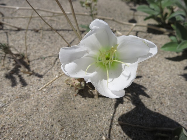
There was one disappointment for me, in wildflowers: I had missed the Desert Lillies. They had apparently been unusually plentiful this spring, and I saw lots of plants, but they were all past flowering.
The Desert Lilly was one flower I had read about that I had hoped to see, but there’s always another time. Actually, I might have to try a couple other times: once a bit earlier in the year to see the Desert Lillies, and once later, to see the agave plants in bloom. But there were so many amazing flowers that I did see, I couldn’t stay disappointed.
When I left Borrego Springs in the afternoon, I drove up into the mountains and soon was away from desert vegetation and back among trees and grasses. I was only about halfway back to Los Angeles before I ran into traffic rather suddenly. It spread out a bit after a while and things moved faster, but never too fast for me. I got a little lost getting to my hotel, a Super 8 in Costa Mesa, but managed to find it. Google said the hotel was about 40 minutes away from the airport, but I planned to give it plenty of time.
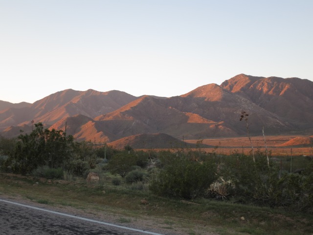
I got up early and left while it was still cool, before the sun peeked over the mountains. I would have liked to be able to stay longer at Butterfield Ranch and explore — it seems like there are plenty of things to do right there. Maybe another time. Meanwhile, the sun lighting up the nearby mountains was ruggedly beautiful.
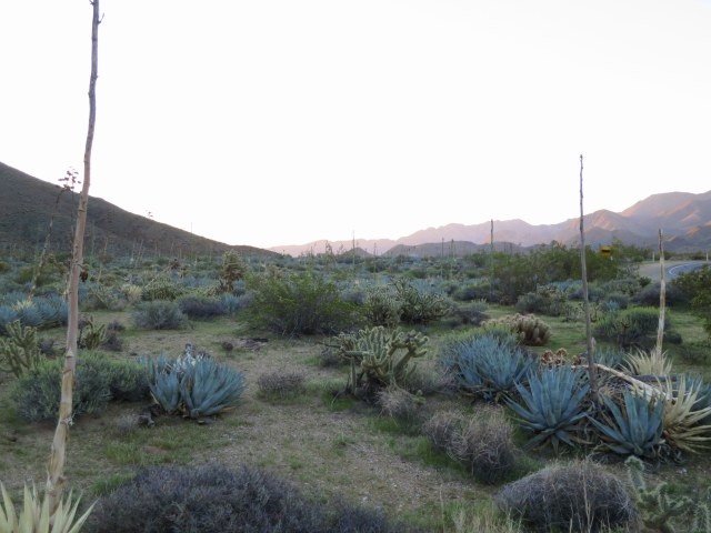
The amount of variety found in what I used to just lump together as “desert” amazes me. This morning, I saw so many plants I had only read about that I could have stopped the car just about every minute.
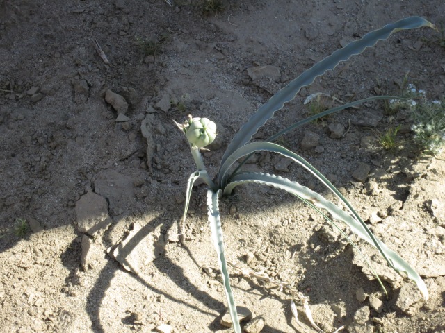
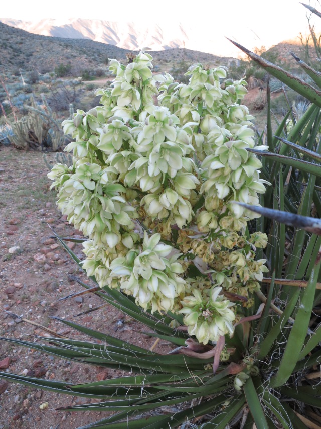
Agave and Cholla. The agave weren’t in bloom yet, but their flower stalks were already as thick as my arm and twice as tall as I am. Some can take up to 20 years to flower, and after they do, the plant dies.
Yucca
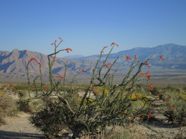
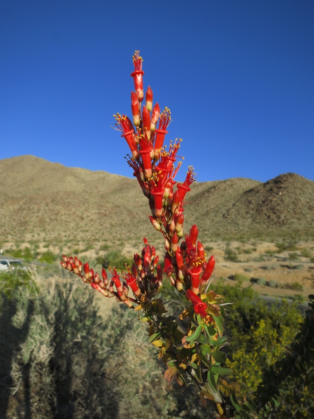
I finally got a chance to see an ocotillo close up as well. They are actually not cacti, although they have spines (most things seem to, in the desert. I got my hand raked by thorns on a very innocent-looking bush). The ocotillo is a many-armed shrub. I learned that they will not put out leaves in dry times; during my visit, rains in the not-too-distant past had caused them to leaf out, and they had brilliant red flowers. I saw some dead branches on the ground; the wood has a strange honeycomb look.
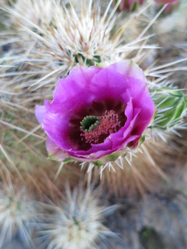
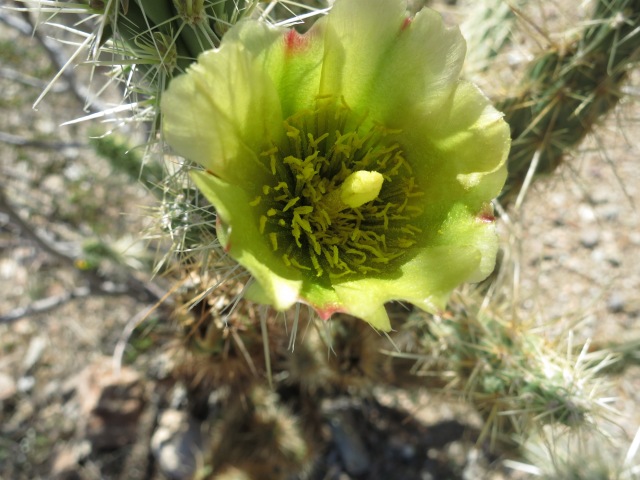
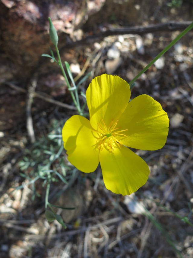
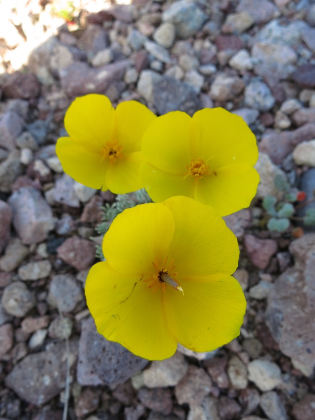
I went over a pass and came down to Borrego Springs, which houses the headquarters for Anza-Borrego Desert State Park. I stopped at a farmer’s market and bought citrus and strawberries, but I wanted to make sure to be in time for a wildflower walk led by a park ranger at 9:00 am. Some people on this walk were wearing shorts, which didn’t seem like a good idea, given the amount of cactus around. My views on this matter were confirmed shortly, when someone on the narrow trail crowded me into brushing against a cholla cactus. It prickled right through my jeans, and stung for half an hour. It would have been much worse on bare skin.
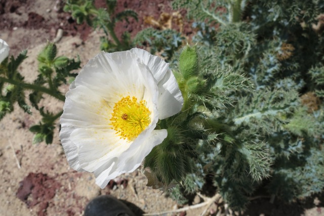
The culpritTiny Yellow Poppy
After the walk was over, I decided to strike out a bit on my own. Next: exploring the desert.
The desert weather is much hotter than I was used to for March, but I’ll take it. Leaving Desert Hot Springs, I started seeing signs: “Dates for Sale Ahead”. Soon there was a sign directing me off the main road, and up to a fence surrounding a house. On the gate was a sign that said, “Walk In”, and when you open the gate a bell rings, and someone comes out from the house and sells you dates. They were excellent. Whenever I can, I try to buy something locally grown when I travel. It’s just that much fresher and better.
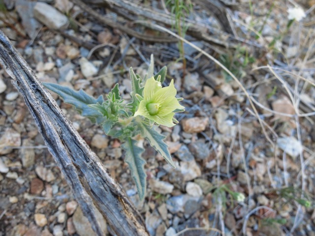
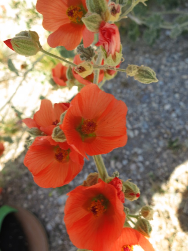
Apricot Mallow
The terrain had become very rocky. Not as in mountains and cliffs, because I had seen those off and on, but as in boulders and pebbles instead of sand and gravel. As I drove along, I could see that eventually I was going to get up into the mountains. But so far I kept on skirting them, heading south along the Salton Sea. At Indio, near the invisible line between the Mojave Desert and the Sonoran, I encountered an abrupt change: the rocky desert suddenly — as in, crossing a bridge — gave way to fine, drifting sand.
I turned straight west, heading for Ocatillo Wells, and soon the road began to climb and, very abruptly, the surroundings changed again. So far, for all the traveling through the desert I had done, I had seen very few cacti. Now I started to see them, as well as what I understood to be ocatillos (whatever those are; they looked from the road like cactus with long, skinny branches), but it was getting dusky and I didn’t have time to stop and investigate tonight.
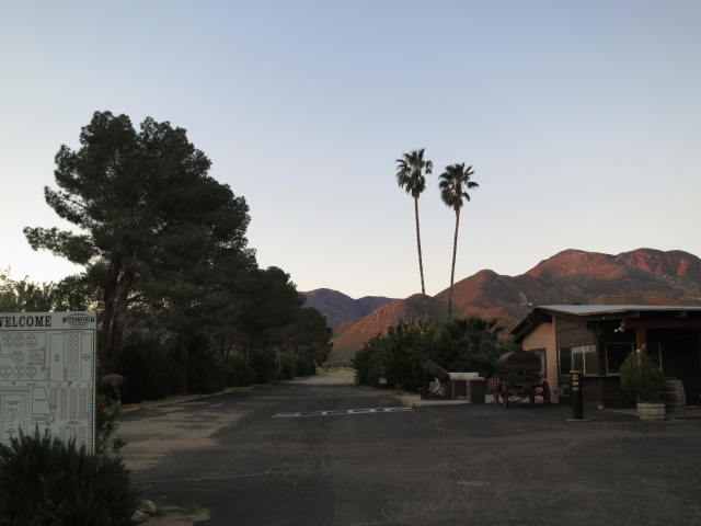
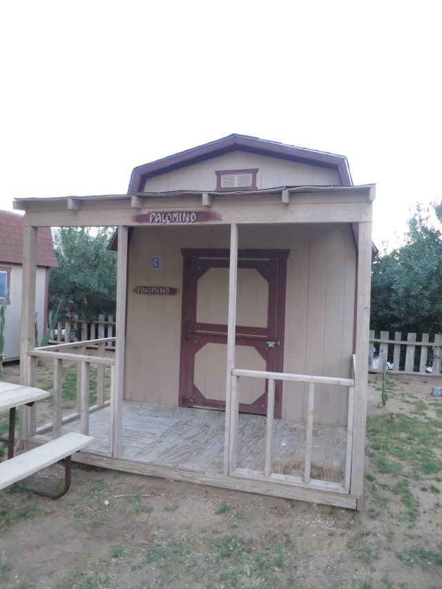
I drove through part of Anza-Borrego Desert State Park, winding around cacti-covered hills and climbing higher and higher. My stopping-place for the night was Butterfield Ranch Resort, in the high desert.
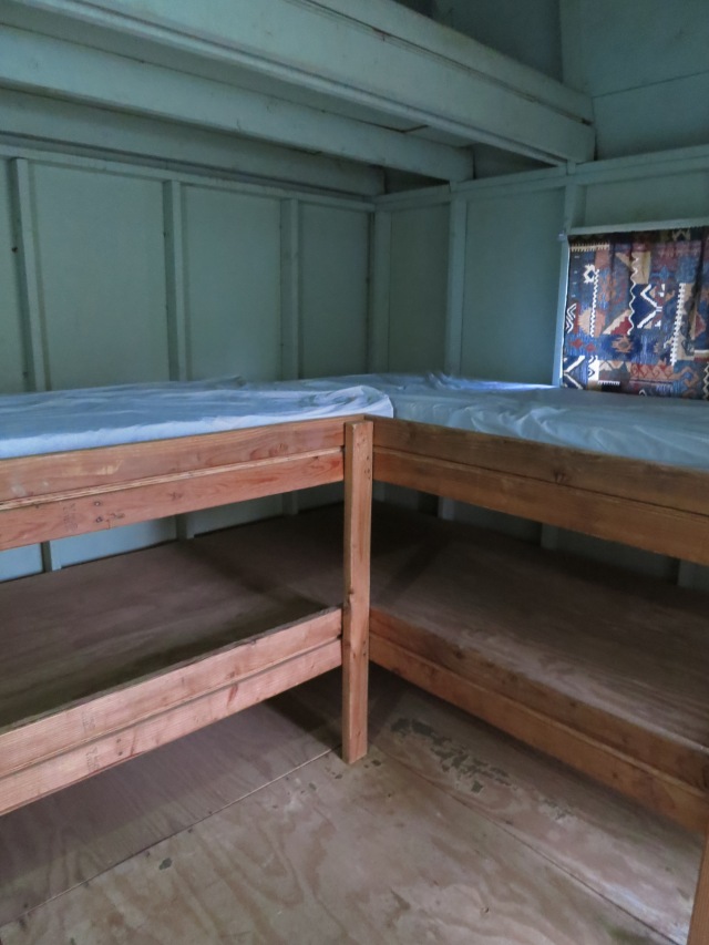
This place has cabins, and campsites for tents and RV’s — and my option, a rustic “bunkhouse” for $30 a night. Once again, I used my trusty sleeping bag.
Beds for four, but mattresses for two?
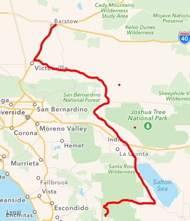
Tomorrow: Anza-Borrego Desert State Park. While driving through tonight, I’ve already seen glimpses of many things I wanted to stop and take a closer look at. Time was short, but I’ve made a mental note. My (long) travels for the day:
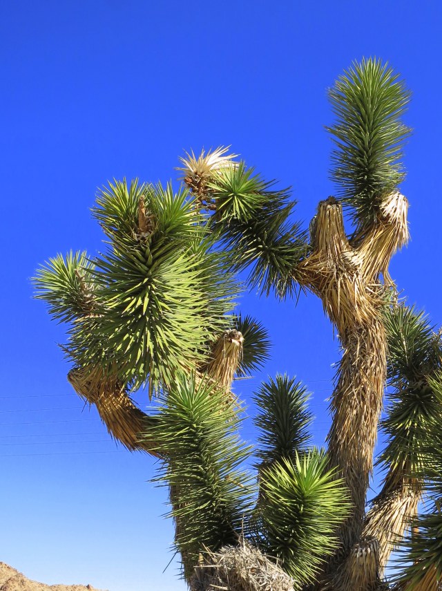
Barstow, California, sits squarely in the Mojave Desert. A distinct feature of the Mojave is its Joshua Trees. I had seen a number of these while driving, but not up close. Today I had to stop to satisfy my curiosity as to what they were really like. Cactus? No, actually a species of yucca. The leaves (?) are just as sharp as they look, especially the dry ones. (One of my bad habits when visiting strange places is the impulse to touch everything sharp or spiked to see if it really means it). Joshua Trees can live up to a thousand years.
I went through Victorville and Apple Valley, skirting the San Bernandino Mountains, then east through a very lonely area. The few towns along my way, and the homes and ranches, looked like a part of the desert itself: low, often sandy-colored buildings rising right out of the sage and scrub, clinging determinedly to existence, tough and no-frills. I stopped at a gas station along the way and asked to use their restroom; I was handed a key and about 12 inches of toilet paper. The bathroom itself was in an outbuilding, with its broken lock supplemented by a padlock and chain, with no water in the sink and no paper towels.
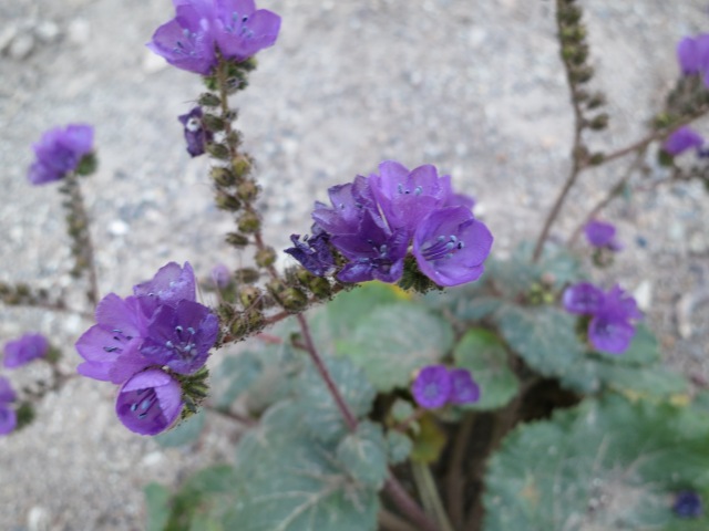
California Bluebells
This section of the Mojave was sandy, with a surprising amount of scrubby bushes, which for some reason I didn’t expect. There were no trees, except for homesteads where they had been planted and tended, and at the occasional spring. A spring is a very valuable possession here.
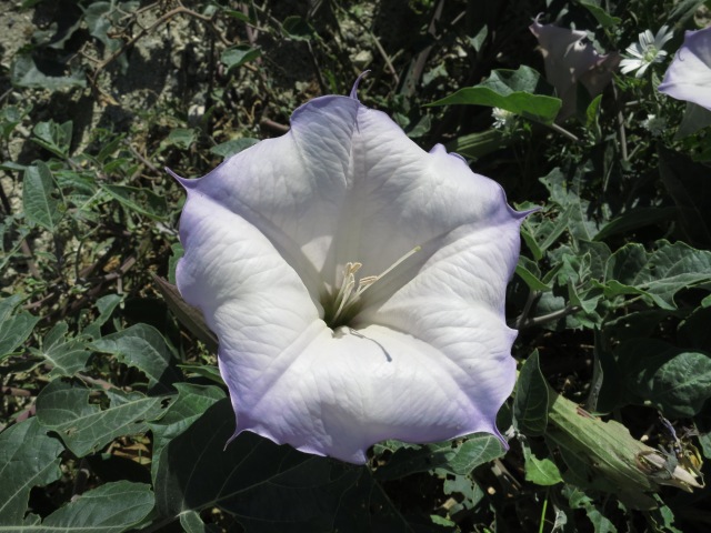
Jimson Weed
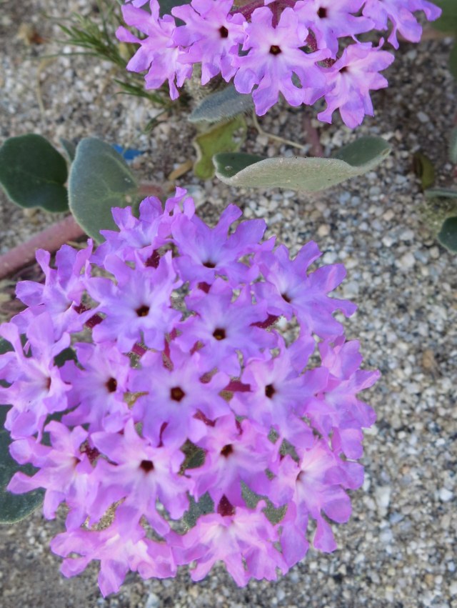
Sand Verbena
By around noon, I arrived in Desert Hot Springs, a somewhat flashy city known for (who could have guessed?) an abundance of hot mineral springs. Of course, the springs aren’t just sitting out there for anybody; numerous resorts and spas have sprung up to pipe in the waters and charge people for using them. However, I wanted to try it out, so I took a break from driving and stopped at Miracle Springs Resort and Spa. A daily pass was around $14, and the mineral pools were included for people who were guests in their hotel or who were having spa services. I checked in, and given a locker key and directed to the women’ dressing room. The lighting was dimmed, there was soft music playing, and there was a big pitcher of cold mineral water with cucumber slices floating in it. Miracle Springs boasts that they have both hot and cold mineral springs, and that unlike some, their mineral water has a pleasant taste. The dressing room also had showers, complete with a basket of little shampoo and lotion bottles, and a sauna. I spent a while in the sauna, then tried out the 9 pools with different temperature water with the desert sun bright overhead in a blue, blue sky. After all the driving I’d been doing, it was very relaxing, and time seemed to stand still. I could see staying there in the hotel someday, lazing around with nowhere to go and nothing else to do, but today I had to move on after a break of several hours. Up next: leaving the Mojave and entering the Sonoran desert.
Furnace Creek in Death Valley is 190 feet below sea level, but Badwater Basin is lower yet. I drove along the road leading through the basin, stopping briefly at Golden Canyon, but ultimately deciding I didn’t have time to hike it. However, as I was fumbling around in my food kit, I cut my finger on a butter knife, of all things. Because it was blunt, the cut was kind of a bad one, bleeding enough that a band-aid wouldn’t stay on. I wound up having to cut a strip off a towel with my pocketknife, very raggedly, and wrap that around the finger to stop the bleeding. So for the rest of the day I sported this very clumsy, very makeshift bandage in the sight of all the tourists.
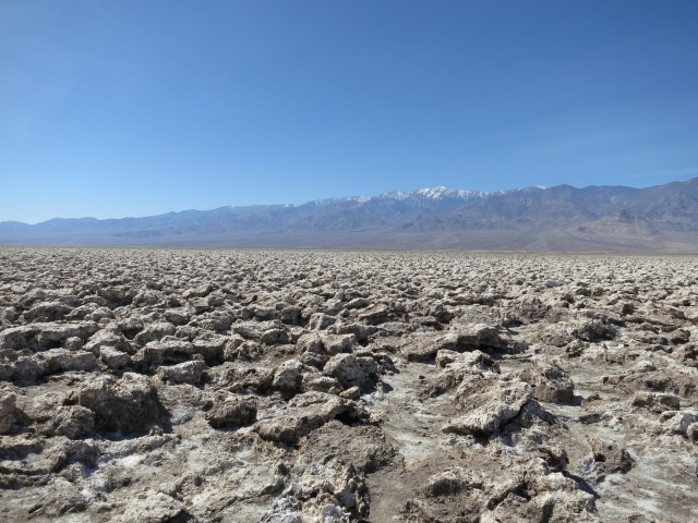
Next on Badwater Road was Devil’s Golf Course. This is an expanse of chunky, jagged salt formations. It wasn’t white, because of dirt and mud mixed in, but looking closely you could see the salt’s crystalline structure. Even though it was dirty, I did taste it. I had to.
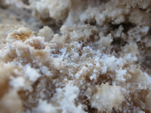
Close-up of salt crystals
There were signs cautioning you if you tried to walk across the uneven ground; you could easily step wrong and break a bone, or cut your skin right open on the jagged and sharp formations. All I could think of were the pioneers who came this way, maybe not knowing what lay ahead, and tried to cross. What a harsh, inhospitable landscape. Besides the barren rockiness that would have made getting around difficult, the vast expanse of Death Valley has practically no drinkable water. The sun beats down from an unclouded sky — and that’s during their cool season. The salt would have coated their clothing, equipment, and skin, cracking and corroding.
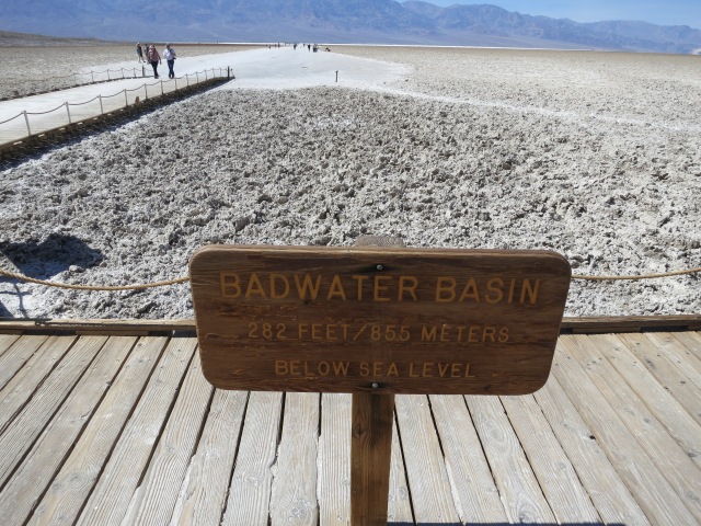
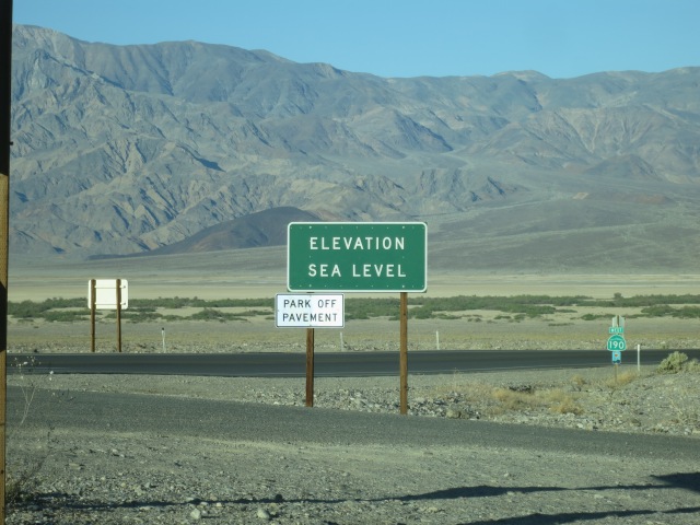
My next stop was Badwater itself. At 282 feet below sea level, this is the lowest spot in the continent.
There is a spring here, but it is salt — hence the name, Bad Water. Unlike Devil’s Golf Course, it was soft. It looked like table salt, if a bit mixed with sand. It was damp. You could dig a little hole and find water. I wore sunglasses because of the brightness of the sun reflecting off all that white, but I forgot about one thing: how fast it can burn. I was starting to sunburn on my winter skin after only a half hour on the salt flats.
My original plan called for me to continue on this road and out of the park through Jubilee Pass, but the road was closed further down because of washouts. So I backtracked, stopping to take pictures of the fields of flowers growing right next to the salt flats.
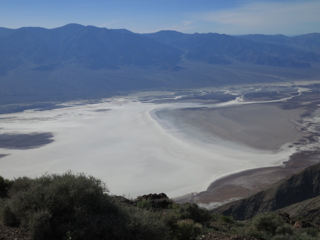
My last stop before leaving the park was Dante’s View. From this peak, you can look down almost a mile to Badwater below. Interestingly, I got a cell phone signal here — the only time while I was in the park.
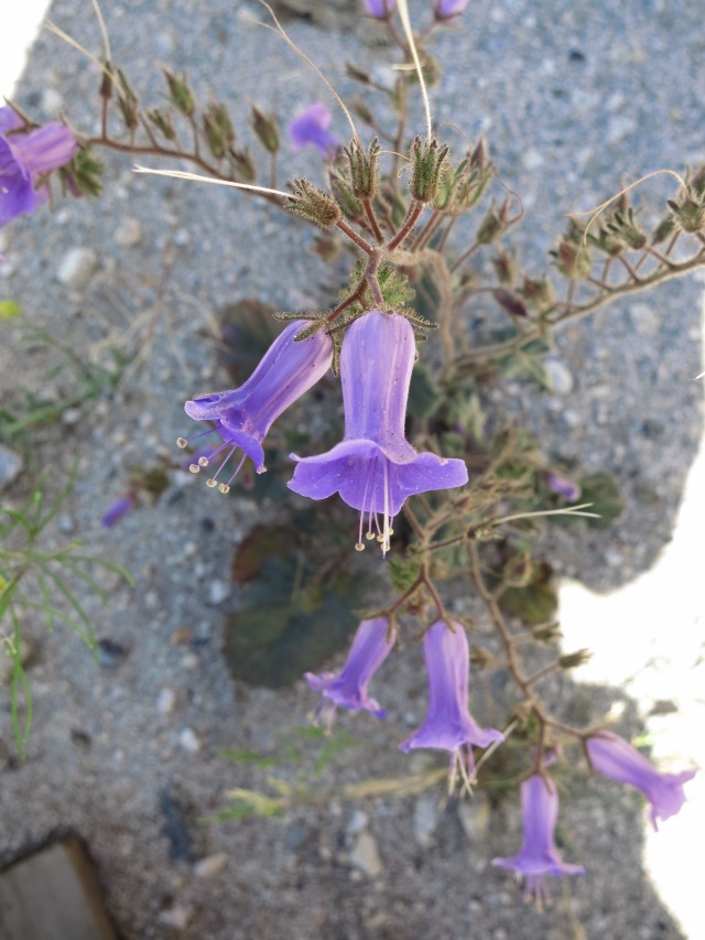
As I climbed in altitude, different flowers grew.
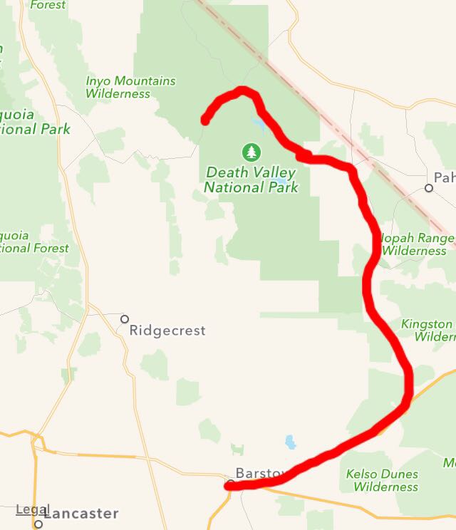
I left Death Valley reluctantly, heading east and south. There is a lot of history there, which I didn’t get time to look at, at all, and I only touched on some of the high points of natural wonder. I headed out the east entrance, turning south through some pretty remote country, until I hit I-15, and then back west to Barstow. I stayed at the Day’s Inn, Lenwood; because I had Wyndham Rewards points, I got my room for just $25. There was a pool (which I didn’t have time to use), a refrigerator, and microwave. The only complaint I had was that I couldn’t get the wifi to work, but living unconnected for a few days isn’t really a bad thing. Tomorrow: a long drive through two deserts.
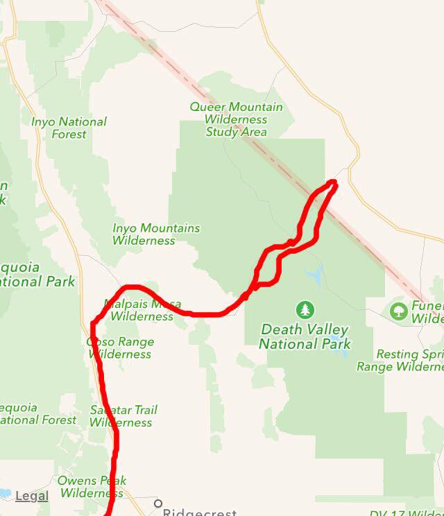
Today’s travels (not counting all the backtracking I did within Death Valley:
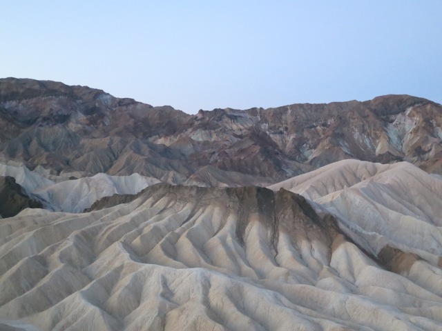
I slept quite comfortably in the tent cabin; it was cold, but my sleeping bag was warm enough, and being up off the ground makes all the difference in the world. I got up at 4:45, because I wanted to see the sunrise from Zabriskie Point, which was 60 miles away. Like yesterday’s sunset at the sand dunes, a Zabriskie Point sunrise is just one of the “things to do” in Death Valley.
When I got there, it was still well before sunrise. It was a bit chilly outside, but a lot of people were arriving and getting set up for photography. I took some “before” shots of the badlands all around. They looked kind of gray and featureless, like the sand dunes after sunset the previous night.
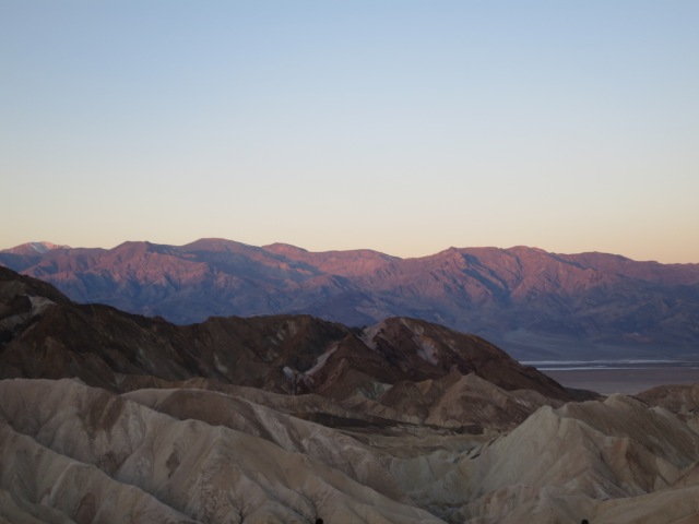
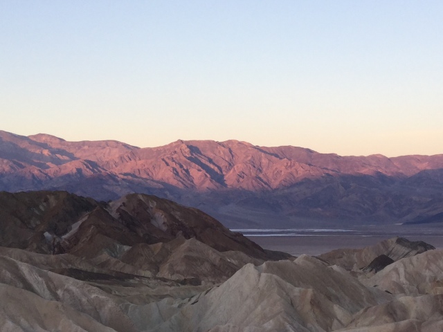
I’ve watched many a sunrise. But never facing away from the sun. At Zabriskie Point, you put your back to the sunrise and face west. When the sun first starts to peek over the mountains behind, it colors the mountain-tips ahead pink, which gradually creeps down the mountain-sides, while all the foreground is still in shadow.
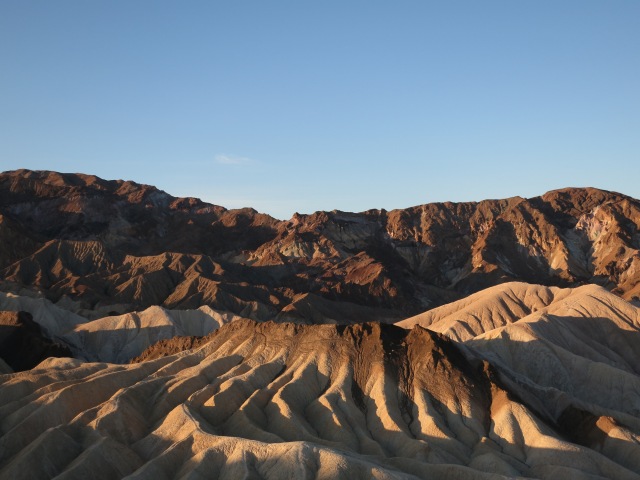
When the sun finally climbs high enough to light the nearby rocks, the shadows spring out, showing up every fold and ridge and bringing out color contrasts. There was maybe a half hour, maybe not quite, where the lighting brought out this contrast. Then the sun rose higher still, and the moment of magic was over: everything gradually faded into normal rock.
I had found a brochure at the ranger’s station notifying that there would be a “wildflower walk” this morning at 9. At the meeting place, there were probably about 20 cars lined up beside the road, and at nine o’clock the leader started off, and we all swung into line behind. It was only a few miles before everybody stopped again, and got out. “In a normal year, this would be bare gravel,” said the park ranger. He’s worked at Death Valley for 25 years, and this is the third superbloom he’s seen.
We walked around and the ranger pointed out different flowers, giving their names and calling attention to sensory things such as touch and smell.
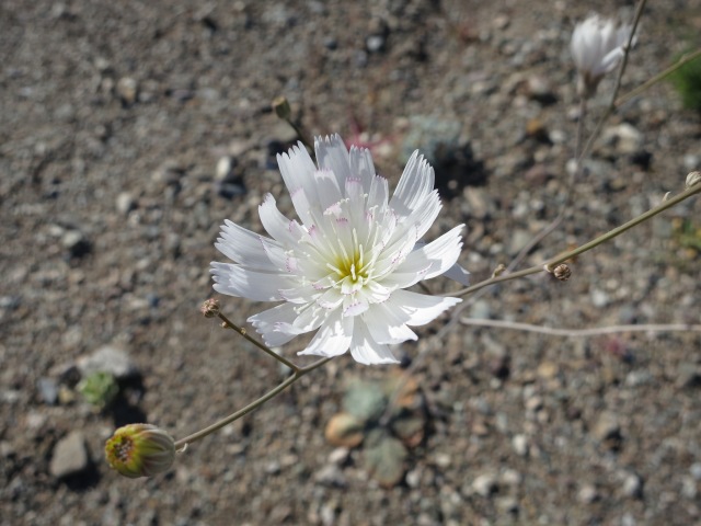
TurtlebackScorpion PlantGravel Ghost
He explained that many of these flowers have seeds with a protective coating that inhibits sprouting. This ensures that the flower won’t spring up with a little rain shower, then shrivel before it can produce a seed. If there is enough rain to wash off the coating, the flower has enough moisture to complete its life cycle. He also said that some flowers have their own pollinator insect, that hatches out of its egg when conditions are right for the plant to bloom. All around us there were caterpillars feasting on one certain plant, but not before it had gone to seed. The caterpillars produce a sphinx moth which pollinates that flower, then lays eggs which hatch in time to eat the plant after it has produced seeds.
Still only about 11 o’clock in the morning, and next up is a quick trip to some of Death Valley’s best known sites.
Death Valley has the record for the highest recorded temperature on the planet. 134 degrees F, back in 1913. That must have been a wild year, because the lowest temperature ever recorded in Death Valley, 15 degrees, happened that year too. We hear so much these days about climate change causing weather extremes, but it appears that extremes are not confined to our current conditions.
An average of 192 days a year have temperatures that top 90 degrees. These are all air temperature measurements. The temperature of the ground surface can reach 200 degrees. That’s pretty hot; water boils at 212. Temperatures like that could turn any day into a survival situation, which is why park rangers advise sticking to the higher elevations during the summer, or at least only coming down into the valley in the early morning and late evening.
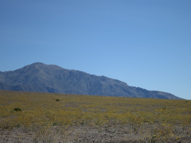
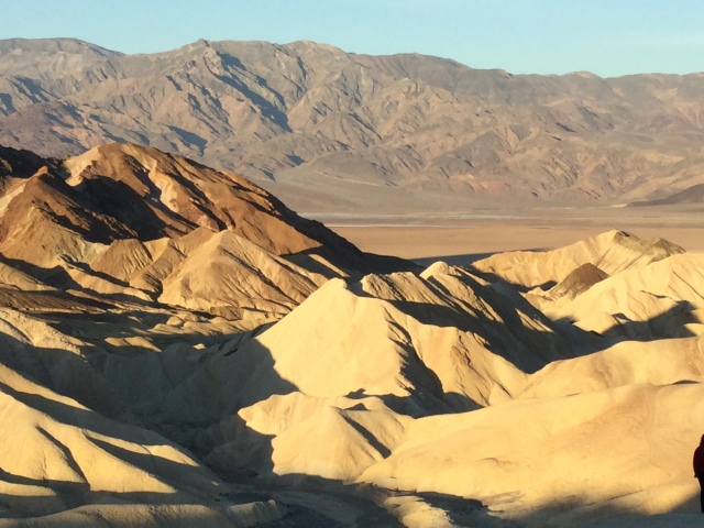
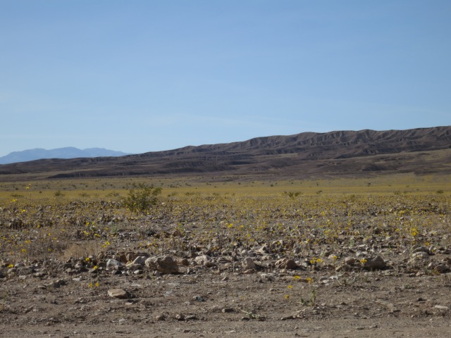
The picture of a desert in my mind had been a long stretch of unbroken sand. Death Valley is as desert as anything in North America, but instead of sand was all rock and gravel. The flash floods of early winter had left heaps and piles of rock, looking more like a disturbed construction site — or a gravel mining pit — than my idea of a desert. The fact that anything could manage to grow there, struggling amidst the gravel, is a wonderment. It’s the harshest environment I’ve ever seen.
At the Stovepipe Wells Ranger Station, I bought my park pass and got a map showing highlights where the current best areas for wildflowers were. One was the Beatty Cutoff and Daylight Pass road, not far away. So I went there and drove over Daylight Pass, and a few feet into Nevada. Another state to check off my list!
This coating of wildflowers only happens in superbloom years. Any other spring, it would just be barren rock and gravel.
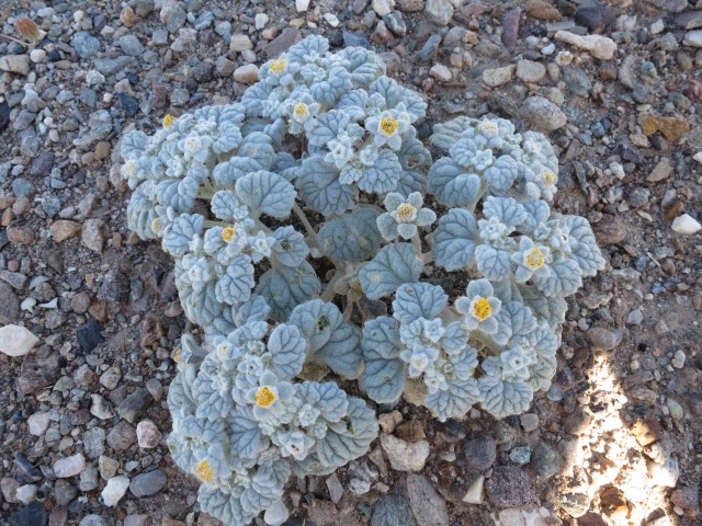
There were, indeed, a lot of wildflowers along this road, signs of the once-in-a-decade “superbloom” that happens when the rain conditions are just right. Although the yellow flowers are most obvious from the road, when you get out and look there are white and purple flowers among them.
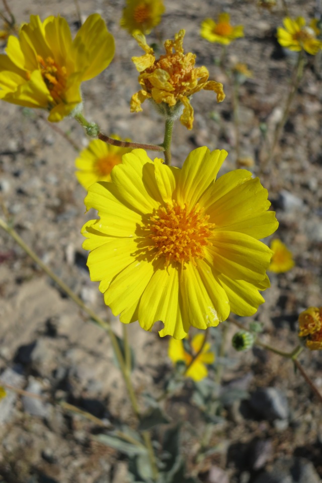
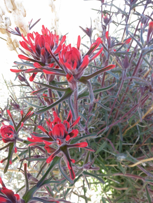
“Desert Gold”Desert Five-SpotDesert Prickly PoppyIn the higher elevations near Daylight Pass: Desert Paintbrush
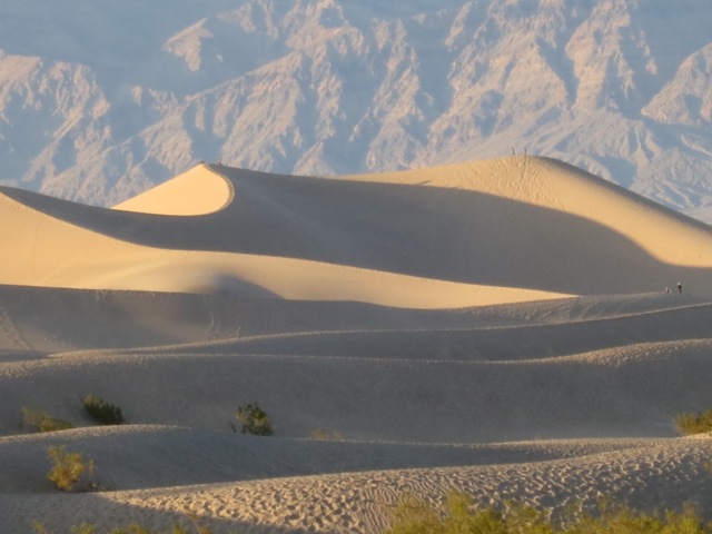
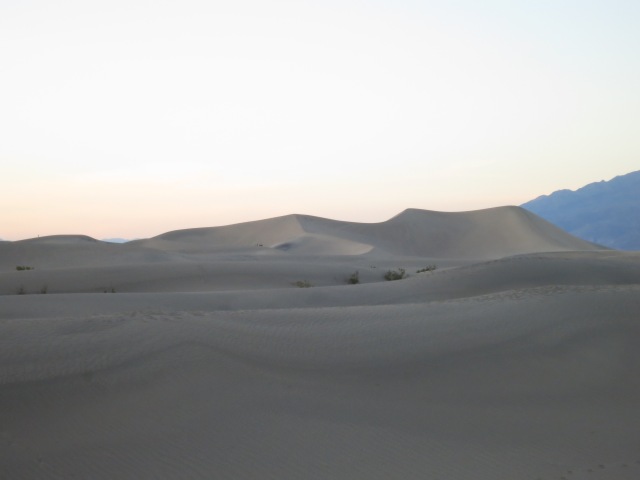
By evening, I had backtracked to the sand dunes by Stovepipe Wells. Spending sunset at the dunes was very unoriginal of me, but the dramatic contrast of light and shadow was worth it. The dunes a little to the east had less traffic, and so the sand was smoother and less marked up.
If it reminds you of Star Wars, you’re right: the Stovepipe Wells dunes were used as a filming location for Tatooine.
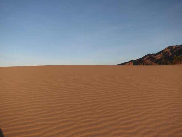
After the sun set behind the mountains, the dunes turned a shapeless gray.
I trekked back to the parking area, mindful of the sidewinders that the sign warned come out at night. Then it was back to Panamint Springs Resort to get ready for an early start the next morning. Their website said they had wifi, but when I asked in the general store/office, they told me that it went down months ago and hasn’t worked since. Another note: gas prices in Death Valley can be 50 cents-$1 more than surrounding areas, and there are only three places to buy gas.
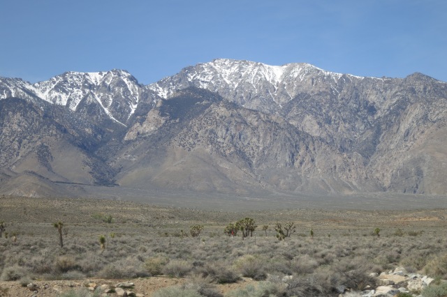
I sampled the motel’s breakfast, and was on the road by about 8:30. It didn’t take long to get completely away from the city, into an area that seemed much more sparsely populated, and much more sparsely vegetated! I went north, driving through Red Rock Canyon State Park, and saw mountains getting closer as I neared the lower tip of the Sierra Nevadas. After a while, I saw my very first Joshua trees, although they looked a little stunted — maybe this wasn’t their ideal climate.
Real mountains, with snow on top! And Joshua trees.
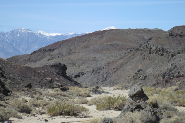
Eventually I turned east, heading for Death Valley, and began to drive up into the Panamint Range. These mountains, the western doorstep to Death Valley, are some of the most desolate-looking things I’ve seen in my life. They don’t look as though anything could, or would, grow on them.
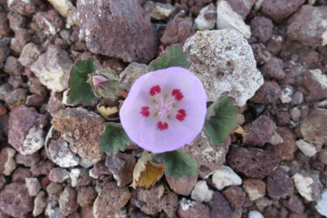
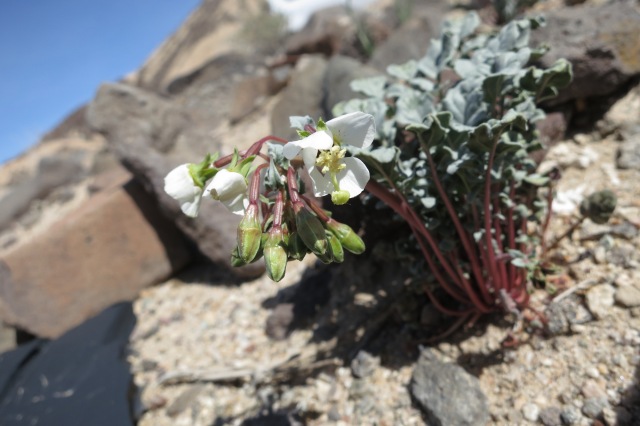
But things do grow. When I got out of the car and looked, I discovered there were wildflowers even here: tiny things, clinging wherever they can. I discovered later that locally these kinds of flowers are called “belly-flowers”, because you really have to get down on your belly to see them. They’re that small.
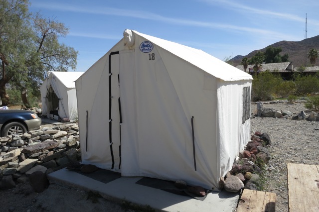
About 2:00 in the afternoon, I arrived at the Panamint Springs resort, and checked into the tent cabin I was going to occupy for the night. I had thought of camping, as hotel rooms in Death Valley start around $80 and can easily be $200 per night. But I didn’t really want to add the dimension of camping in a totally strange environment to my already packed schedule. This seemed like a nice compromise: for $35 a night, you get a cement floor, canvas walls and roof, and a couple of cots. Bedding is extra, but I stuffed my military surplus sleeping bag into my luggage. A good thing, too, because the temperatures were forecast to get down to 40 degrees or lower that night, at that elevation. It seemed a strange thing, for a place with the hottest recorded temperature on the planet, to be no warmer than if I had stayed at home. But of course, the mountain temperatures are cooler anyway.
Quite cozy.
After taking a look at my home for the evening, I drove down into the Panamint Valley, and up into the mountains beyond. The highest elevation I saw was nearly 5,000 feet, and from there it descends to sea level within 17 miles. As the road sloped steadily downward from the pass, I decided to see how far I could really go without touching the accelerator. The answer? Fourteen and a half miles. For a flatlander like me, that was one of the high points of the trip.
The temperatures were what a warm summer day at home would be, but everywhere I saw reminders that the summer heat in Death Valley is intense. There were signs warning against vehicle breakdowns and overheating, and stations for radiator water marked on the map. I had made a grocery store stop before leaving Palmdale and civilization, and had 4 gallons of water safely stowed away in my backseat, so I felt ready to explore with the daylight hours I had left.